Expressive Mapping of Resilient Futures (EMoRF) was a collaborative project between Kounkuey Design Initiative (KDI) and King’s College London (KCL), funded by the UK Natural Environment Research Council (NERC). The project explored innovative, qualitative GIS approaches to map resilience in informal settlements, specifically Kibera, Nairobi, to support more inclusive urban planning and disaster risk management aligned with the Sendai Framework and the UN Sustainable Development Goals (SDGs).
context
Traditional urban planning often relies on quantitative data and technical GIS tools that miss the social and emotional dimensions of resilience. In places like Kibera, where resilience is shaped by social ties, local knowledge, and informal systems, this data gap leaves public authorities poorly equipped to respond effectively to disasters or plan equitably.
Additionally, current knowledge infrastructures tend to exclude local voices, particularly in informal settlements. EMoRF addresses this by integrating community experiences, relationships, and perspectives into mapping processes—making the invisible, visible in urban planning.
process
EMoRF used qualitative GIS methods to spatially represent social, emotional, and relational data. These methods included:
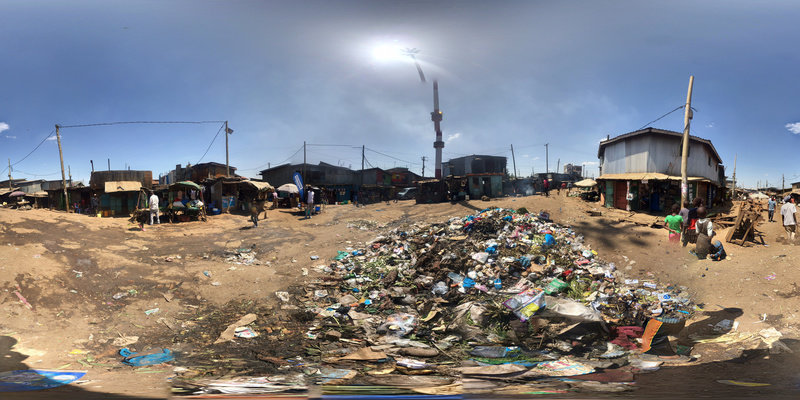
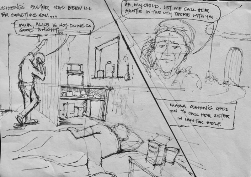
Storyspheres: Immersive 360º photographs embedded with community-recorded audio stories, enabled viewers to virtually experience a place through multiple personal narratives. They are accessible via web browser, smartphone, or low-cost VR headset.
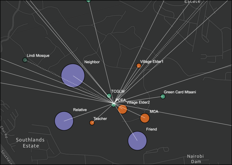
Social Network Mapping visualized the connections between individuals and organizations that provide support during crises. These maps highlighted the spatial extent of social support networks and helped identify key nodes to strengthen community resilience.
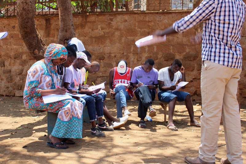
Focus Group Discussions: Conducted both in person and virtually (via WhatsApp or Telegram), these discussions gathered insights into how different groups experience and navigate their neighborhoods. Facilitators collected spatial references during these sessions to inform the GIS data.
Social network mapping
solution
By integrating stories, social connections, and community knowledge into mapping tools, EMoRF provided an alternative to top-down, technocratic planning. The project demonstrated how community-informed resilience maps could guide more equitable planning decisions—rooted in empathy, context, and participation.
EMoRF also supported capacity building among urban professionals. KDI conducted targeted training to introduce government officials, urban planners, and GIS professionals to qualitative GIS approaches. These sessions equipped practitioners with tools to interpret and integrate lived experiences into formal planning systems, helping bridge the gap between data and people
impact
The EMoRF project led to several important impacts. It enhanced understanding for urban and disaster response planners by providing access to new layers of knowledge grounded in community experience. By incorporating informal knowledge, such as trust networks and social support systems, into spatial planning, the project brought greater visibility to social assets that are often overlooked. This approach enhanced more equitable urban planning by encouraging participatory and context-sensitive methods that recognize power dynamics and historical exclusion.
Through the use of innovative tools like Storyspheres and social network maps, EMoRF offered interactive and accessible ways to engage communities, with the potential to scale across other cities and regions. The project also included targeted training sessions for urban planners, GIS professionals, and government officials from Nairobi County, introducing them to qualitative GIS tools and participatory approaches to resilience mapping. Additionally, EMoRF contributed to global knowledge by advancing the use of qualitative GIS as a valuable methodology for mapping resilience in complex urban environments.